How does Asseti utilize data?
This article refers to how Asseti consumes and uses data.
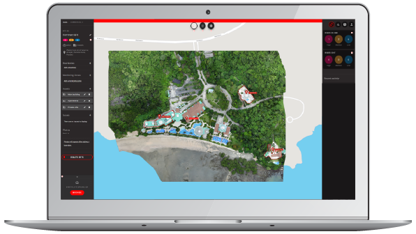 The screenshot above shows the expanded data upload bay, at the lower left of the screen.
Data consumption
Asseti consumes timestamped and geolocated data of all types, and sorts data in the same way. Datasets are automatically arranged at the appropriate spatial coordinates, and clustered into timestamp groupings.
Data processing
Initial data processing is dependent on the data type. Raster image datasets are often the first uploaded to a site, to form a foundational central map. Raster images are from satellite, drone, manned aircraft, or ground-based captures. Raster imagery is sorted and stitched into orthographic maps, and used in the creation of a 3D model.
This process is automatic, and all images uploaded will be assigned for 3D modeling.
Point clouds are similarly temporally and geolocated, with the 3D model formed by the point cloud itself rather than mathematical mapping.
Data types that cannot be used in the creation of an orthographic or vector map will be visible and accessible at their geolocation.
Temporal view
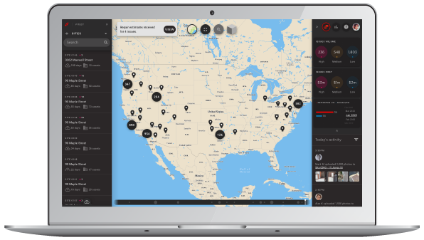 Where multiple temporal datasets are available, they can be individually visualized using the temporal slider seen at the bottom-center of the map area in the image above.
Multiple datasets are not combined into a single view; the datasets are instead processed and considered separately. Asseti automatically assesses dataset groupings. Where the data is image-based, orthos are made for each timestamp group and users can use the slider shown in the image above to compare the discrete datasets for changing conditions. The detail included at each timestamp incorporates all data feeds for that time and geolocation - for example, if the subscriber has imagery, SCADA inputs, and temperature sensor detail for the selected time period, then that combination of data will be layered and visible at that point on the slider.
Users benefit from the layering of different timestamp datasets by visual comparison and manually evaluating the change over time.
Asseti analytics
The information until this point is common to all uploaded data. Additional processing and insights are available depending on the account tier of the subscriber. Examples of additional data processing and insights available include:
- Layering of 3rd party data sources with own-data, such as weather
- Laying of live data streams from our library or or yours
- Automated defect or issue tagging, including repair estimates
- Asseti Paradigm, leveraging our historical record of similar circumstances with similar assets to inform robust predictive insights
For more information please contact Asseti using the chat bubble at lower right, or through our contact form. Alternatively, to try Asseti for yourself please claim your free trial account via the button below.
Note: the full library of Asseti Help Center articles is available to registered account holders.